Trail Details
Park at the flag pole at the foot of Harbour St. or at Geddes Park adjacent to the Queen St. bridge, and enjoy the sights and sounds of the Penetangore River. This trail meanders along the river, under the Queen St. Bridge, then through the Geddes Environmental Park. From here you cross a permanent bridge and follow alongside the S Penetangore River east to Highway 21. The trail contains varied terrain with sections on sidewalks. Some bridges are seasonal, please check news for trail limitations prior to use.
- Length: ~6km
- Difficulty Rating: 2-3 (See scale)
Highlights
- River access
- Kincardine Harbour and Marina
- Blue and Green trail access
- Downtown Kincardine
Additional Information
- Parking:
- Geddes Park
- Harbour Street
Guided Tour
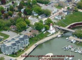
The River Trail begins at the base of the Kincardine Lighthouse (R02). Passing under the Huron Terrace bridge follow the river south beside the fishing club and hatchery. After entering the paved road and starting up the hill keep and eye to the right. The trail will now take you along the river and under the Queen St. bridge.
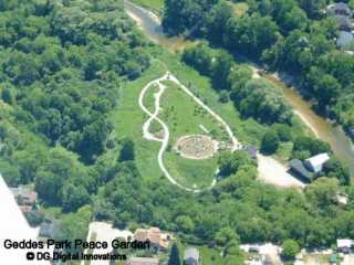
You are now entering Geddes Environmental Park (R08), home of the Labyrinth Peace Garden. After visiting the gardens continue on until you reach the wooded area. The trail now splits (R09) and is a short loop.
In the middle of the loop follow the trail (R10) to the Geddes Bridge (seasonal). After crossing the bridge bear left (R11). 100 metres further on the trail turns right (R12) into the woods and up a moderate hill ( Wayland Walk extension). At the top you will be at the south end of Pearce Lane which lead to the Davidson Trail (Blue Trail) . Continuing straight ahead to enter the north end of McGaw Dr. Walk south on McGaw turning right when you reach Scott. St. At the end of Scott St. look left and walk behind the small brick pump house.
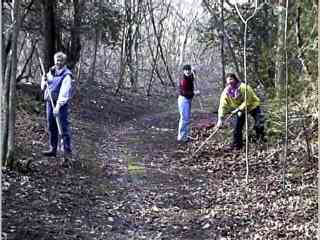
Walking down the hill bear left and follow the trail and small bridged area to the bottom. The river is straight ahead and the trail continues into the woods to your left (R14). You will now be following the north shore of the Penetangore River. The trail splits at (R14), take the left trail and watch for a small trail to the right. Look for one of the oldest trees in Kincardine. You will exit the loop at (R15).
Keep an eye out for (G19). This is the trail to the south side of the Penetangore River and the Valley Trail (Green Trail).
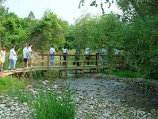
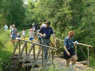
Continuing on enjoy the remote walk and listen for the birds. If you look carefully you will see the stumps of trees that have been removed by beavers. A short distance ahead pass over a small creek. The bridge was built by the Kincardine Ventures. (R16)
Approaching (R17) there is a small loop. The trail ends at the river junction just beyond (R19).
Maps & Resources
- 2024 Trail Map
- Trail Users Code
- Trail Map (ArcGIS)
- GPS Waypoints